
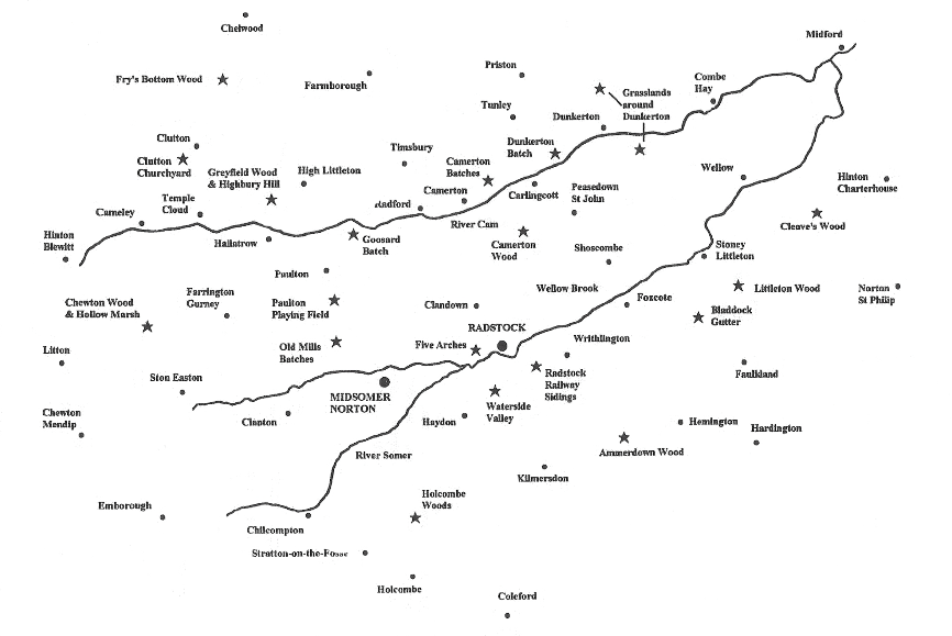
Cam Valley Wildlife Group area maps
Villages and wildlife sites
The three images below show the Cam Valley Wildlife Group area in different forms – the first shows rivers, roads and some of the wildlife areas, the second shows named towns and villages and the third shows the 1 km grid squares. We give a list of named locations below the hand-drawn maps, each one a named 1 km grid square, many of which are named after the town or village within it.
Please note: the locations on the hand-drawn maps are illustrative only and, therefore, not completely accurate. A useful tool for obtaining grid references can be found here.

1 km grid squares is the group’s area
The 1 km grid squares in our area are shown below, as some projects record at 1 km square level. The Flora project uses this grid system for its records, but does record some plants by a more specific grid reference when it is best to do so, for example for the recording of rare plants. The pre-fix for all these grid squares is ST.


